Understood
This website is using cookies. We and our partners use cookies on this site to improve our service, perform analytics, personalize advertising, measure advertising performance, and remember website prefrences. By using the site, you consent to these cookies. More details
  • Blog
  • Summary
  • Details
  • Pilots
  • Results
  • Registration

Event info

We invite pilots from Peru and from all over the world to participate in the Peruvian Championship and Paragliding Open "AYACUCHO XC 2019" taking place in and around the city of Ayacucho (Peru), located on the eastern slope of the Andes, from 4 to 9 June 2019.

Expand page for more details

Flying site

CITY OF AYACUCHO

Coordinates: 13° 9'37.44 "S 74° 13'32.91"W

Ayacucho is a relatively new place for paragliding. The city is located 560 km by road southeast of the city of Lima, capital of Peru, and has a height of 2756 meters and has 150,000 inhabitants.

Expand page for more details
Go to Pilot List
  • 50 Pilots max allowed
  • 5 Countries presented
  • ✅ All certified wings allowed
  • 🏆 FAI Status = CAT 2 🏅
  • left before start of event

Contacts

Event info

We invite pilots from Peru and from all over the world to participate in the Peruvian Championship and Paragliding Open "AYACUCHO XC 2019" taking place in and around the city of Ayacucho (Peru), located on the eastern slope of the Andes, from 4 to 9 June 2019.

This year's edition of the event is a category FAI 2 paragliding competition for the third consecutive year.

Invitamos a todos los pilotos a nivel nacional e internacional a participar en el Campeonato Nacional y Open de Parapente "AYACUCHO XC 2019" que se llevará a cabo en la localidad de Ayacucho (Perú), ubicada en la vertiente oriental de la Cordillera de los Andes, del 4 al 9 de junio 2019.

Este año el evento será una competencia de la categoría FAI 2 por el tercer año consecutivo.

Flying site

CITY OF AYACUCHO

Coordinates: 13° 9'37.44 "S 74° 13'32.91"W

Ayacucho is a relatively new place for paragliding. The city is located 560 km by road southeast of the city of Lima, capital of Peru, and has a height of 2756 meters and has 150,000 inhabitants. It is also known as the "City of Churches" for its numerous colonial temples.

The climate is temperate and dry, with an average temperature of 18 ° C and an average relative humidity of 56%. The rainy season is between November and March.

OFFICIAL TAKE OFF:

Coordinates: 13 ° 12'19.30 "S 74 ° 14'30.99" W

The official take off is located at Cerro Campanayoc (District of Carmen Alto) at 3520 meters and 30 minutes by car from the center of Ayacucho. It is accessible by a gauge.

OFFICIAL LANDING:

Coordinates: 13 ° 10'59.25 "S 74 ° 13'30.66" W

It is located in the southern part of the city in the Quicapata Community Sports Complex (District of Carmen Alto).

TASKS:

The tasks will be carried out in the Ayacucho valley; on the plateau and in the south, south east or south west of the city, according to the weather forecasts and the conditions of those days.

These areas are characterized by wide valleys, plateaus up to 4200 meters above sea level and green pampas. It is recommended to land near a town or road since some roads are difficult to access. Therefore, the waypoints have been located in the vicinity of the routes that facilitate the transportation back to the city.

Tasks are expected between 40 and 70 km.


FLIGHT CONDITIONS:

The thermal conditions are quite manageable and controllable in this area, being thermal up to +4 or +5 m / s. On a good day, it is possible to reach cloud base between 5000 and 5500 m.

It is advisable to acclimatize before flight days and, if you consider necessary, have an oxygen system.


AIRSPACE RESTRICTIONS:

Ayacucho has an airport with commercial activities. However, these do not interfere with this competition. Also, the control tower will keep abreast of our schedules and activities to have better coordination and maintain the safety of the case.
----------
CIUDAD DE AYACUCHO

Coordenadas: 13° 9'37.44"S 74°13'32.91"O

Ayacucho es un lugar relativamente nuevo para la práctica del parapente. La ciudad se encuentra a 560 km por carretera al sudeste de la ciudad de Lima, capital de Perú, y tiene una altura de 2756 msnm y cuenta con 150,000 habitantes. Se le conoce también como la “Ciudad de las Iglesias” por sus numerosos templos coloniales.

El clima es templado y seco, con una temperatura promedio de 18°C y una humedad relativa promedio de 56%. La temporada de lluvias es entre los meses de noviembre y marzo.

DESPEGUE OFICIAL:

Coordenadas: 13°12'19.30"S 74°14'30.99"O

El despegue oficial se encuentra en el Cerro Campanayoc (Distrito de Carmen Alto) a 3520 msnm y a 30 minutos en auto desde el centro de Ayacucho. Es accesible por una trocha.

ATERRIZAJE OFICIAL:

Coordenadas: 13°10'59.25"S 74°13'30.66"O

Se encuentra en la parte sur de la ciudad en el Complejo Deportivo de la Comunidad de Quicapata (Distrito de Carmen Alto).

PRUEBAS:

Las pruebas se realizaran en el valle de Ayacucho, sobre la meseta “El Plateu” y en la zona sur, sur este o sur oeste de la ciudad, según los pronósticos meteorológicos y las condiciones de esas fechas.

Estas zonas se caracterizan por tener valles amplios, mesetas de hasta 4200 msnm y pampas verdes. Se recomienda aterrizar cerca de una población o carretera puesto que algunas vías son de difícil acceso. Por ello, los puntos de ruta han sido ubicados en las cercanías a las vías que faciliten el transporte de regreso a la ciudad.

Se espera realizar pruebas entre 40 y 70 km.


CONDICIONES DE VUELO:

Las condiciones térmicas son bastante manejables y controlables en esta zona, encontrándose térmicas de hasta +4 o +5 m/s. En un buen día, es posible alcanzar base nube entre los 5000 y los 5500 msnm.

Se recomienda aclimatarse previo a los días de vuelo y, en caso consideren necesario, contar con un sistema de oxígeno.


RESTRICCIONES DE ESPACIO AÉREO:

Ayacucho cuenta con un aeropuerto con actividades aerocomerciales; sin embargo, éstas no interfieren con esta competencia. Asimismo, la torre de control se mantendrá al tanto de nuestros horarios y actividades para tener una mejor coordinación y mantener la seguridad del caso.

Selection and entry fee

REQUIREMENT FOR PILOTS TO ENTER THIS COMPETITION:
• Valid FAI Sporting License*
• Certified Flying equipment: paraglider, harness, rescue, and helmet.
• GPS (w/cable)
• Mobile Phone (WhatsApp Number and Peruvian Number)
• Radio VHF
• Registration fee payment stub
• Complete registration form ready before Task 1
• Accept local valid regulations.
• External power units for recharging mobile phones (optional)
• Valid insurance for paragliding in Peru (recommended)

*For Peruvian Pilots please contact the organizer to issue the FAI Sporting License.

ENTRY FEE*:
• Until May 15th: US$ 120.00
• After May 15th: US$ 150.00

* a discount of US$ 20.00 is granted to Peruvian pilots with valid APVL-membership


Bank details:

BCP - Banco de Crédito del Perú
SWIFT/BIC: BCPLPEPLXXX
Account N° 194-36891016-1-51 (USD)
CCI: 002-19413689101615192
Account holder: Marcel Werner Burkard

• Proof payment to be sent to ayacuchoxc@apvl.org.pe with the subject “Registration Ayacucho XC 2019”.

INCLUDES:
• Tag ID
• Event T-Shirt
• Transport to Take off
• Retreive from Landing Place
• 1 lunch pack per day
• Waypoint List
• Map
• Prizes for the winners

Prize fund and scoring categories

1°, 2°, 3° ranked in Open
1°, 2°, 3° ranked in Sport
1°, 2°, 3° ranked in National
1°, 2°, 3° ranked in Women*

* min. 5 participants

General schedule

Tuesday, Jun 4, 2019
08:30 - 14:00 - Official Training Day
18:30 - 20:00 - Official Registration
20:00 - 21:00 - Opening ceremony and Mandatory Safety Briefing

Wednesday, Jun 5 - Sunday Jun 9, 2019
Contest flying days

Sunday, Jun 9, 2019
20:00 - Prize-giving and closing ceremony

Daily schedule

08:00 - Headquarter opens
08:30 - Transport to take-off
09:30 - Meet Director / Task and Safety Committee meetings
09:45 - Pilots' briefing / Previous task official results / Task definition
11:00 - Take-off window opens
18:30 - Scoring office opens
22:00 - Provisional results

Accommodation and Activities

How to get here

By Plane

If you like to come by plane, you can take one from the city of Lima and in less than 1 hour you can enjoy all the attractions of the city. From the City of Lima there are two commercial airlines that have two daily flights each (in the morning and in the afternoon). We recommend to approach the airport 2 hours before the flight to check in and load of luggage in the warehouse (maximum 1 piece of 23 kg).

The Comercial Airlines are:
- LATAM Airlines: https://www.latam.com
- LC Perú: http://www.lcperu.pe/

Or check other websites like: despegar.com

By Bus

If you want to travel by land, we recommend traveling by bus. The best known route is Lima-Ayacucho (500 kilometers), which lasts approximately 9 hours. If you are in Cuzco, the trip can last between 10 to 12 hours; Finally, if parts from Huancayo, the walk will last between 7 or 9 hours.

- Cruz Del Sur: www.cruzdelsur.com.pe
- RedBus: https://www.redbus.pe

By Taxi

Once in Ayacucho can be transported within the city on foot (for short distances), by taxi (average of S / .5.00 per trip) or bus (average of S / .1.00 per trip).

2 De Mayo 792, Ayacucho, Pérou
Ayacucho Peru

Downloads

Waypoint files

Organizers

FEPEA
FEDERACION PERUANA AERODEPORTIVA
APVL
ASOCIACION PERUANA DE VUELO LIBRE
Marcel Burkard
Main Organizer
Franz Schilter
Meet Director
Alonso Contreras
Coordinator
Gerardo Cortada
Safety Director

Contacts

Socials

Gender:
confirmed
selected
registered

Click here for the event WPRS forecast

SORT BUTTONS
Women     confirmed

ID:

Manufacturer =
Model =
Size =
Max Weight =
Certification =

Harness =
Men     confirmed

ID:

Manufacturer =
Model =
Size =
Max Weight =
Certification =

Harness =
# Name Rank Sponsor Glider Status
Category Tagline Participant Email Phone Description Price
Please sign in and register before posting your own classifieds.

Tasks and results

Task 1

05 Jun, 2019

61.2 km — Race to goal

Task results:
Overall results:

Task 2

06 Jun, 2019

56.4 km — Race to goal

Task results:
Overall results:

Task 3

07 Jun, 2019

35.9 km — Race to goal

Task results:
Overall results:

Task 4

08 Jun, 2019

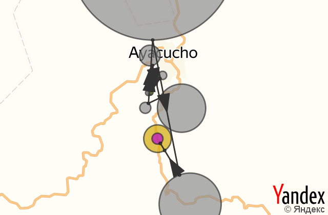
60.9 km — Race to goal
Task results:
Overall results:

Task 5

09 Jun, 2019

49.2 km — Race to goal

Task results:
Overall results:
Please sign in first.